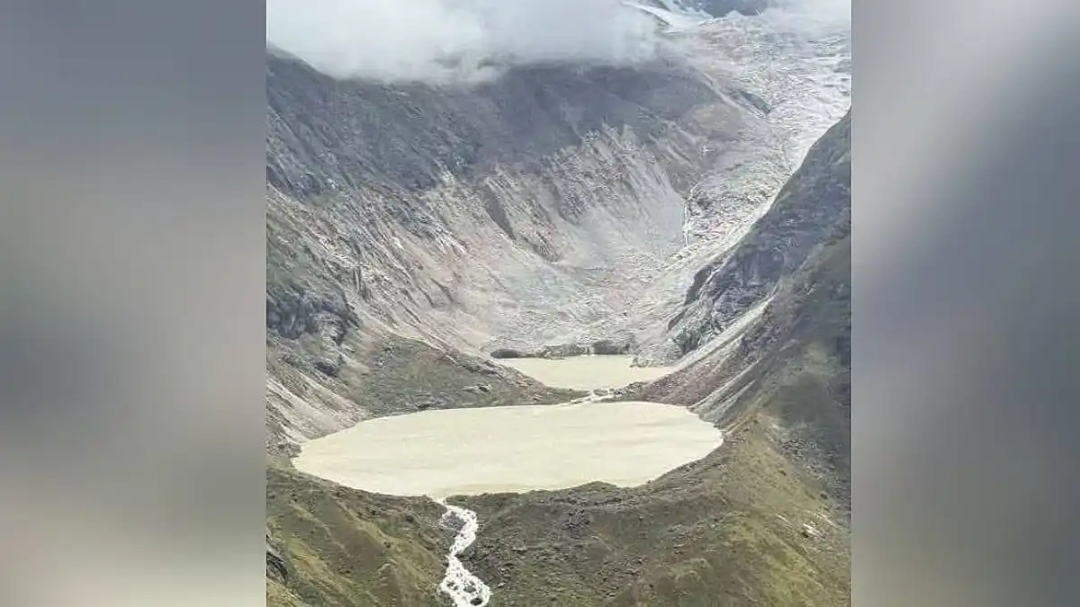
As darkness fell on the late evening of Thursday, October 29, the sensors in the Bhutanese Himalayan region showed a spike. The alarms did not stay confined in their national boundaries for long.
Automated early warning alarms went off in the Mochu and Punatsangchhu valleys of Bhutan right after the sensors showed a spike. By the next morning, people were being asked by officials in West Bengal and Assam to keep away from the banks of the Sankosh River.
An enormous glacial lake outburst flood occurred in the Sintaphu Lake at night on Thursday, with flood warnings issued for the low-lying areas of North Bengal and Assam.
There is conflicting information about the name of the lake. NewsBytes refers to it as Chintaphu, located in Gasa district. Another source says that its name is Shintaphu and is located in the Mochu sub-basin of the Gasa district. One more source gives another name, Lemthang Lake, from the post of a West Bengal minister.
In India, however, the response came from the state ministers. West Bengal Forest Minister Manoj Kumar Oraon advised people living on the banks of Sankosh in Alipurduar to vacate their places.
Minister of State Nisith Pramanik said in an interview with ANI that people living on the banks of Sankosh and its tributaries should vacate their places immediately.
The Cooch Behar district administration also issued a warning to people living on the banks of the river.
The recommendation was merely a preventive one, and the sources used for analysis provided no figures of the number of people evacuated.
The concerned authorities made mention of the districts on either side of the border that were under threat. These include Dhubri in Assam and the Darjeeling Hills and Alipurduar and Jalpaiguri in West Bengal. In Assam, besides the mentioned regions, there are other districts being watched carefully, such as Kokrajhar, Baksa, Chirang, and Dhubri. There is a red alert signal issued in the Sankosh River system.
As stated by the officials, a sudden increase in water level can be expected in the districts of Alipurduar and Dhubri. The state disaster management and police teams started surveillance work in the embankments and announced through public address systems the evacuation of low-lying areas prone to floods.
The responsibility lies on the Sankosh river itself. It originates in northern Bhutan under the name Puna Tsang Chu and flows into the Brahmaputra River in Assam. In India, the Sankosh flows through the boundary between Assam and West Bengal.
It gives a lot of time for a flood wave to cover a great distance. The water that enters the river in Gasa's high valley may flow to the plain areas within hours.
There are no reports of deaths or serious damages. The floods were on the move downriver while the warnings were being sent out, and there might be a different story as data is collected from water level stations.
The Indian authorities mentioned that they had been maintaining regular contact with Bhutan. Disaster management teams were monitoring water levels and discharge rates.
Outbreaks of such magnitude have occurred previously in this area. On October 7, 1994, a partial collapse of the moraine around Luggye Lake led to a flooding incident that resulted in the deaths of 21 people in Bhutan.
The 2017 disaster in Lemthang Tsho was on a considerably smaller scale. Its effects were relatively minor and limited to only 30 kilometers downstream, killing four horses and destroying four timber bridges.
The threat is widespread. Bhutan has some 2,674 glacial lakes, with the majority of the potentially threatening lakes draining into the Manas and Puna Tsang (Sankosh) watersheds. In the 2017 study, 22 lakes were categorized as critical.
An outburst flood is different from a monsoon flood in that it occurs due to the release of stored water at one go, usually without prior warning. The early warning system for Bhutan and the quick warning system of India are the major lines of defense that turn time spent traveling into time saved.
Some things that the people can do include staying away from river banks and low-lying areas, following the instructions of the local authorities, and avoiding flooded regions.